
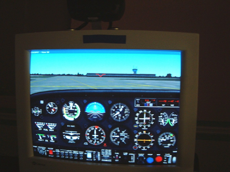
I take a break, from time to time, using Flight Simulator where I find, my flying the simulator, acting as it does, to releive tension, is a great nerve calmer. As I don't have the free time get GKE running, especially when the weather is bad, resort to my Flight Simulator. Even the planning for a session, is a needed diversion.
![]()
![]()
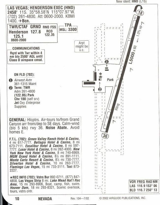
So, starting south of Las Vegas at Henderson Field (HND- Elev 2492), I headed north to St. George (SGU - Elev 2941) (where people climbed up in the ridge to watch the hydrogen bombs being tested - as they were downwind of the fallout suffered accordingly).
St. George Utah
(In the early 1950's, life was peaceful in the almost exclusively Mormon community in the small town of St. George, Utah. But then, radiation linked illnesses began to appear. Families lost mothers and husbands, children died. St. George and its people were the victims of radioactive dust, drifting over from atmospheric atomic tests, carried out in the Nevada desert. Only in recent years has the government acknowledged weapons testing as the likely cause of killing or sickening civilians downwind. The Justice Department started a compensation program that requires victims to prove they have a qualifying type of cancer and that they were residents of counties in southern Utah, Nevada, or Arizona. Many victims have been compensated, but the money has run out and an estimated $70 million worth of claims are still unfulfilled. Producer Wayne Brittenden of the British Broadcasting Corporation, talked to the 'downwinders' and reports on the official cover-up by the U.S. government and the Mormon church.)
Then I flew over Cedar Breaks National Monument
.
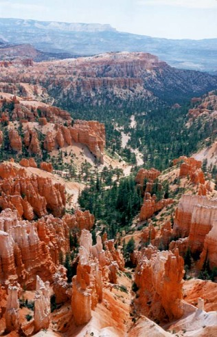
Cedar Breaks National Monument
(Located close to I-15 near Cedar City, Cedar Breaks National Monument contains a steep, bowl-shaped cliff face eroded into the west side of the Markagunt Plateau, quite similar to Bryce Canyon National Park , with colourful rock strata and many strange rock shapes. The access road (UT 148) circles the cliff edge from which the spectacular limestone formations can be seen, extending 2,000 feet downwards and 3 miles across, all eroded from the Claron Formation of the Pink Cliffs - the highest and most geologically recent component of the great series of escarpments that stretches eastwards across south Utah, known as the Grand Staircase. Some areas of the cliffs are even more brightly coloured than Bryce, and present an enchanting mixture of delicate shades of red, yellow, white, pink and orange, like the icing on a extravagant wedding cake.
Approach: Cedar Breaks can be reached from four directions. In the north, UT 143 climbs quite steeply from Parowan on I-15, passing the Brian Head ski resort and into the northern part of the national monument, then turning away west, through more hilly woodland to Panguitch near Red Canyon. The other road is UT 14, approaching from Cedar City up a steep canyon - it ascends 4,000 feet in 18 miles, and once past the turning to Cedar Breaks continues to US 89 at Long Valley Junction. The scenic drive through the monument reaches a summit of 10,400 feet, and all of the surroundings are of similar height, so during the winter the area receives heavy snowfall, which often does not melt completely until July when maximum temperatures are only around 70 °F. For this reason, the road through the park is normally closed to vehicles between November and April.
Attractions: Besides the immediate spectacle, the views further westwards from the cliffs are also dramatic, extending to the Nevada desert on clear days. During spring and summer, the Alpine-like meadows on the plateau become filled with grasses and brightly coloured wildflowers. A small campground, open during the summer only, is located near Point Supreme within the park, but even in August, the nighttime temperatures may still fall below freezing. Hiking in the national monument is quite limited as there are no trails down the cliff face, but short walks along the rim and through pine forests lead to several alternative viewpoints. So, there is not that much to do but this is a pleasant place to rest and camp for a while in the summer.
Trails: Within the national monument
there is one main trail along the rim and another through woodland to a
sheltered pond. Spectra Point/Ramparts Overlook is an easy two mile hike,
starting from the visitor center, heading along the cliff edge for a short
distance then on to a promontory that juts out into the southern part of
the amphitheater. In contrast, the Alpine Ponds Trail has no major viewpoints
of the formations but instead encounters trees, meadows, flowers and wildlife
en route to a tranquil pool fed by meting snow. Just beyond the north edge
of the monument, a longer trail (Rattlesnake Creek) descends through forests
of fir, spruce and aspen into the Ashdown Gorge Wilderness, a remote region
centered around a steep, narrow limestone ravine. Wildflowers are abundant
along the path, especially the upper part, and it offers occasional distant
views of the Cedar Breaks cliffs, eventually descending into the red rock
formations)
I headed towards Mesquite, passing Hurrecane Mesa, (ILB - Elev 3347) and on to Zion National Park.
Zion National Park
![]()
Then up to The Mountain of Mystery then back down to fly over the tunnel (Checkerboard Mesa), over to Clear Creek (pvt - Elev 6138) to Mt. Camel Junction, (were we used to stop at the Motel - when we went by car). I then flew southward from Panaguich to Bryce Canyon (BCE - Elev 7586), [12].
I used the Flight Simulator to follow a previous flight. I had to alter my flight in the '80's because of a DME problem. Previosly I traveled a long distance (from Los Vegas to Toronto by a Dodge Minivan). Now I wanted to see what it looked like from the air. I used [9] to Zion National Park and [9] from there. Then had followed [alt 89] to Kanab Kanab (KNB Elev 4867) to down to Page (PGE - Elev 4565) where we stopped for the night.
With the Flight Simulator, I passed Bryce Canyon and followed [12]. The Capitol Reefs National Park is just past Torrey. When you pass out of the valley the cliffs are lined with erosion pockets. The scenery becomes bleak and bare. Cainsville is oon the way, but it is only at the to the junction of [24] to Hanksville (HVE- Elev 4444) [24 and 89,] that it seens more prosperous.
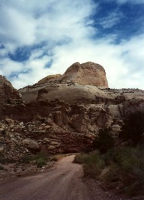
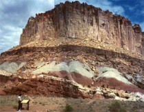
(Here are two shots of the area - I have another photo of the old schoolhouse in the shelter of the valley. I will attempt to find it. The Waterpocket Fold, a 100-mile long wrinkle in the earth's crust, extends 70 miles from nearby Thousand Lake Mountain to the Colorado River (now Lake Powell). Capitol Reef National Park, Utah was established to protect this grand and colorful geologic feature, as well as the historical and cultural history that abound in the area)
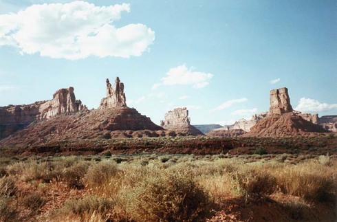
I headed south on [94] passing Glen Canyon National Park (with some spectacular scenery). On the trip, highway [261]. On the way, take a look at the outlook from Cedar Mesa, where some exceptional views are located. There has been a lot of archaeological research done below the mesa. As it is well proctected from the winter winds as well as having a southerly exposure it is an 'ideal' setting. The road drops down to the Valley of the Gods. After that it leads to Mexican Hat [163].
We then turned north on [191]
to Blanding, (BDL - Elev 5865), Utah.
I have added the airport data even though we often had to go via the minivan.
NOT TO BE USED FOR FLIGHT
PLANNING
© 1980, 1999 Wright Electroacoustics